
Cliff
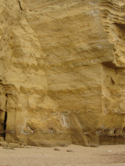
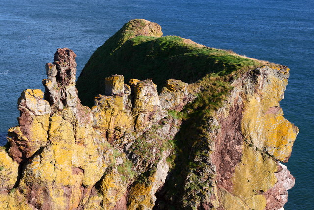
A steep rock face formed by erosion and weathering.

Syced · CC0
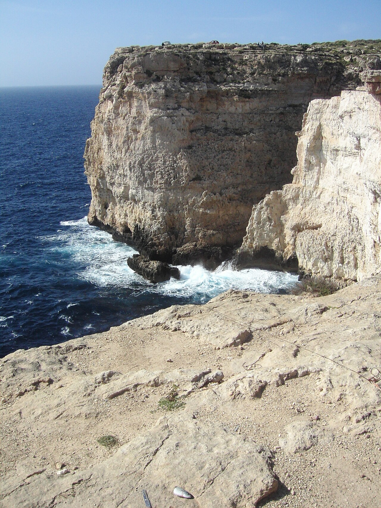
A cliff is an area of rock with a general angle defined by the vertical, or nearly vertical. Cliffs are formed by weathering and erosion, with the effect of gravity, and are common on coasts, in mountainous areas, escarpments, and along rivers. They are usually composed of rock resistant to weathering, such as sandstone, limestone, chalk, dolomite, granite, or basalt.
- Formation processes
- Weathering, erosion, gravity
- Common rock types
- Sandstone, limestone, chalk, dolomite, granite, basalt
- Related landform
- Escarpment (or scarp)
- Typical base feature
- Scree slope or talus
- Etymology origin
- Old English 'clif', cognate with Dutch, Low German, Old Norse; possibly from Latin 'clivus' or 'clevus'
Lore & Background
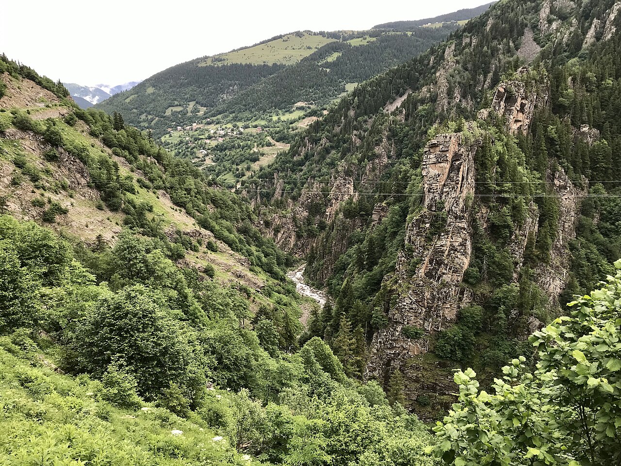
Cliffs are formed by the processes of weathering and erosion, with the effect of gravity. They are common on coasts, in mountainous areas, escarpments, and along rivers. Most cliffs have some form of scree slope at their base; in arid areas these are exposed jumbles of fallen rock, while in areas of higher moisture a soil slope may obscure the talus. Many cliffs also feature tributary waterfalls or rock shelters. Coastal erosion may lead to the formation of sea cliffs along a receding coastline.
Reader's Guide
Cliffs are significant as prominent geological features shaped by natural forces over time. They are typically composed of rock resistant to weathering, such as sandstone, limestone, chalk, dolomite, granite, or basalt. An escarpment is a type of cliff formed by the movement of a geologic fault, a landslide, or differential erosion. The British Ordnance Survey distinguishes between cliffs (continuous line along the top edge with projections down the face) and outcrops (continuous lines along lower edge). The highest cliff in the Solar System may be Verona Rupes on Miranda, a moon of Uranus, at approximately 20 km high.
Did You Know?
- The word 'cliff' comes from Old English 'clif', cognate with Dutch, Low German, and Old Norse 'klif'.
- The highest cliff in the Solar System may be Verona Rupes on Miranda, a moon of Uranus, about 20 km high.
- The British Ordnance Survey distinguishes between cliffs (continuous line along top edge) and outcrops (continuous lines along lower edge).
Physical Attributes and Classification
Landforms are defined and sorted according to a set of measurable physical properties, including their elevation above a reference plane, the steepness of their slopes, the direction they face, and their internal structural composition. Stratification patterns, the degree to which bedrock is exposed at the surface, and the type of soil covering a feature all contribute to how a landform is identified and distinguished from its neighbors. At the broadest level, Earth's surface is organized into four principal categories: hills, mountains, plains, and plateaus. Beneath these major divisions sit smaller, more localized features such as basins, buttes, canyons, and valleys. The inventory also extends to water-related structures—rivers, ponds, lakes, bays, peninsulas, and even submerged elements like mid-ocean ridges, volcanic edifices, and the vast oceanic basins. Importantly, the same vocabulary applies across scales: a pond and a lake, or a hill and a mountain, are distinguished primarily by their size rather than by fundamentally different processes. This scale-sensitivity means that what counts as a distinct landform can shift depending on the resolution at which the landscape is examined.
Hierarchy, Scale, and the Vertical Dimension
Landforms are organized in a nested hierarchy. At the very top sit continents and oceans, representing the highest-order divisions of a planetary surface. Within those, individual features can be broken down into named components: the summit or hill-top, the shoulder, the saddle between two peaks, the foreslope, and the backslope. A broader set of generic elements—pits, peaks, channels, ridges, passes, pools, and plains—fills out the vocabulary used to describe terrain at intermediate scales. The vertical dimension of the land surface is called terrain or relief, and its systematic study is topography. When the same concept is applied beneath the water's surface, the term becomes bathymetry. At the finest resolution, elementary landforms represent the smallest homogeneous patches of surface, bounded by lines where properties change abruptly. A single plateau or hill can be recognized at scales ranging from a few hundred meters to several hundred kilometers, making the spatial distribution of landforms inherently scale-dependent, much like the behavior of soils and geological strata.
Formation Processes and Biological Contributions
Landforms arise through a combination of geological, biological, and human-driven processes. Tectonic plate movements beneath the crust are responsible for thrusting up the great hills and mountain ranges that dominate many landscapes. Erosion and deposition, acting over geological time, sculpt and reshape these structures. Human activity adds another layer: canals, ports, and engineered harbors are explicitly excluded from the landform category, yet broader anthropogenic influences can still alter natural terrain. Biological agents play a surprisingly active role. Vegetation stabilizes and shapes dune systems and salt marshes, while colonies of corals and algae build the massive reef structures found in tropical seas. The concept is not limited to Earth; the same terms—mountains, hills, polar caps, valleys—describe surface features on all the terrestrial planets in our solar system. Meanwhile, broad geographic cover types such as deserts, forests, and grasslands are treated as separate from landforms, even though they drape over them.
Scientific Study and Modern Measurement
The dedicated scientific discipline for investigating landforms is geomorphology, which draws on geology, cartography, and increasingly on remote-sensing technology. In the field of name studies, the proper names assigned to individual landform objects—specific mountains, named valleys, particular hills—carry the specialized term oronyms, distinguishing them from general toponyms. For centuries, mapping relief required labor-intensive fieldwork and expensive manual techniques that consumed enormous numbers of person-hours. Cartographers relied on contour lines and triangulated irregular networks to render the third dimension on flat paper. Today, digital elevation models can be generated automatically from data collected by modern satellites and stereoscopic aerial surveillance cameras, dramatically reducing the time and cost of producing detailed terrain datasets. The most precise elevation measurements available are obtained through LIDAR techniques, which capture surface geometry at very fine resolution. Open collaborative efforts, such as the Open-Geomorphometry Project, continue to push the boundaries of how we extract, classify, and characterize landform data for both Earth and other planetary bodies.
Gallery
Frequently Asked Questions
What exactly is a cliff in geological terms?
A cliff is a stretch of rock whose face is oriented at or very near a vertical angle, creating a steep wall-like surface. It is distinguished from gentler slopes by how sharply the rock rises relative to the horizontal plane.
How does a cliff actually form?
Cliffs develop through a combination of weathering, erosion, and the constant pull of gravity acting on weakened rock. Over time, softer material at the base is removed, undercutting the face and causing the steeper sections to collapse or retreat.
Which rock types are most commonly found making up cliffs?
Cliffs tend to be built from rock that resists weathering well, including sandstone, limestone, chalk, dolomite, granite, and basalt. These harder lithologies maintain a near-vertical face while surrounding softer material erodes away.
Where are cliffs most often encountered in a landscape?
You'll typically see cliffs along coastlines, in mountainous terrain, on escarpments (scarps), and along river valleys. A scree slope or talus of broken rock fragments usually accumulates at the base where material has shed from the face.
Where does the word 'cliff' come from?
The term traces back to Old English 'clif,' a word shared with Dutch, Low German, and Old Norse. Some etymologists also link it to the Latin 'clivus' or 'clevus,' meaning a slope or incline.
More in Geology And Landforms 1-17
Spotted an error? Know more?
This is a living reference — every entry is fact-audited, and reader corrections feed straight into our audit queue. Suggest an edit · See this site's audit record