
Artificial island
Human-made landforms built for settlement, defense, or economic purposes.

Luka Peternel · CC BY-SA 4.0
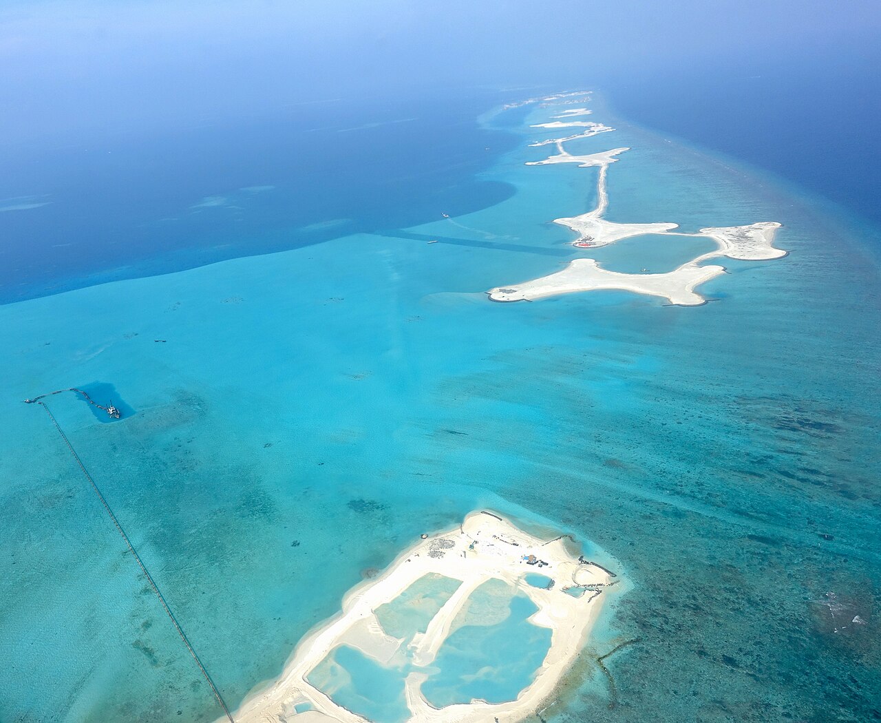
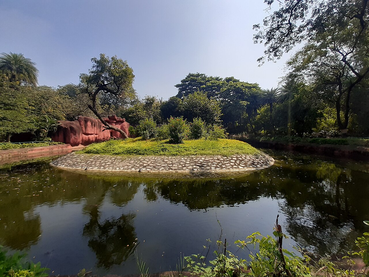
An artificial island or man-made island is an island that has been constructed by humans rather than formed through natural processes. Other definitions may suggest that artificial islands are lands with the characteristics of human intervention in their formation process, while others argue that artificial islands are created by expanding existing islets, constructing on existing reefs, or amalgamating several islets together. Although constructing artificial islands is not a modern phenomenon, there is no clear legal definition of it. Artificial islands may vary in size from small islets reclaimed solely to support a single pillar of a building or structure to those that support entire communities and cities. Archaeologists argue that such islands were created as far back as the Neolithic era. Early artificial islands included floating structures in still waters or wooden or megalithic structures erected in shallow waters (e.g., crannógs and Nan Madol).
- Earliest known permanent artificial isla
- Neolithic crannógs and Nan Madol predate Al-Sayah Island by thousands of years
- Second largest artificial island
- The Pearl-Qatar, approximately 4 km² (Hamad International Airport is on reclaimed land, not an island)
- Notable ancient example
- Tenochtitlan, Aztec city surrounded by chinampas islands
Lore & Background
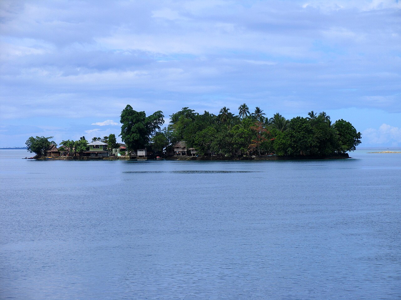
Artificial islands have a long history, with Neolithic examples like crannógs and Nan Madol predating later constructions by thousands of years. Ancient examples include the stilt crannogs of prehistoric Wales, Scotland, and Ireland, the ceremonial centers of Nan Madol in Micronesia, and the floating islands of Lake Titicaca. The Aztec city of Tenochtitlan stood on a small natural island surrounded by countless artificial chinampas islands. In the Solomon Islands, the people of Langa Langa Lagoon and Lau Lagoon built about 60 artificial islands on the reef, including Funaafou, Sulufou, and Adaege, formed one rock at a time for protection from attack and to avoid mosquitoes.
Reader's Guide
Artificial islands have been constructed for millennia for residential, industrial, commercial, structural, and strategic purposes. In modern times, they are usually formed by land reclamation, though some result from valley flooding. The legal definition of artificial islands remains unclear. These islands provide valuable real estate, isolation for specific uses (e.g., Dejima for European merchants, Ellis Island for immigration processing), and protection from rising sea levels. Their construction involves significant engineering challenges, including wave size and structural integrity considerations.
Did You Know?
- The earliest known artificial islands date back to Neolithic crannógs and Nan Madol, thousands of years before Al-Sayah Island in Bahrain.
- The Flevopolder in the Netherlands is a large polder connected to the mainland, not an artificial island.
- The people of Lau Lagoon in the Solomon Islands built artificial islands one rock at a time for protection and health reasons.
- China's artificial island on Fiery Cross Reef houses military barracks and a runway for military aircraft.
Seventy Million Years of Fire
The volcanic story of the Canary Islands stretches back roughly 70 million years, making it one of the longest-running episodes of island-building in the Atlantic. During the first tens of millions of that span, every eruption took place beneath the waves, slowly stacking lava on the ocean floor. It was not until about 20.2 million years ago that accumulated basalt finally breached the surface at several sites, giving birth to the first landmasses. The eastern islands—Lanzarote and Fuerteventura—were the first to rise above the waves, and each island further west followed in sequence, with the westernmost reaching the surface as recently as 1.1 million years ago. Even before the main islands appeared, a cluster of seamounts had been erupting across a broad swathe of the seafloor, including one as far as 380 kilometres north of Lanzarote. The northernmost of these, the Lars seamount, dates to about 68 million years ago, and the seamounts grow progressively younger as you track them southwestward. This long, layered record of submarine and subaerial volcanism makes the archipelago a natural laboratory for understanding how oceanic islands mature over deep geological time.
A Volcanic Province Far from Plate Edges
Unlike most volcanic regions on Earth, the Canary Islands do not sit at a divergent or convergent plate boundary. They rest on the African tectonic plate, well within its interior, far from any active margin. This makes them a textbook case of intraplate volcanism—magma punching through the crust from below without the aid of plate separation or subduction. The oceanic crust beneath the islands is among the oldest in the Atlantic, formed between 175 and 150 million years ago during the breakup of Pangaea, when North America and Northwest Africa began to drift apart. That ancient seafloor, built from igneous and sedimentary layers, provides the foundation on which the volcanic province later developed. The Canary Islands occupy one end of a geological spectrum of deep-ocean volcanic islands, with the Hawaiian archipelago at the opposite extreme. While Hawaiian islands are eventually carried away from their volcanic source and sink, the Canaries have not experienced significant subsidence, meaning their evolutionary sequence—submarine, shield-building, erosional, and post-erosional—plays out without the dramatic drowning phase seen in the Pacific.
From Seamount to Skyline
The seven main islands—Lanzarote, Fuerteventura, Gran Canaria, Tenerife, La Gomera, La Palma, and El Hierro—each began life as an isolated submarine volcano on a seafloor ranging from 1,000 to 4,000 metres deep. Over millions of years, successive lava flows piled upward until the peaks finally broke the surface. The total volume of volcanic rock in the archipelago is staggering: approximately 124,600 cubic kilometres. Yet only about 4 percent of that mass—roughly 4,940 cubic kilometres—sits above the waves; the remaining 96 percent is hidden beneath the ocean. The western islands retain a larger share of their volume above sea level (about 7 percent) compared with the eastern ones (around 2 percent). The archipelago stretches 450 kilometres from east to west, with minor islets and rock formations dotting the waters around each main island. Lanzarote and Fuerteventura are joined by the Canary Ridge and were once a single landmass, sometimes called Mahan, during the Last Glacial Maximum around 20,000 years ago, when global sea levels were lower. Today an 11-kilometre-wide, 40-metre-deep strait separates them.
A Living Volcanic Landscape
The Canary Islands are not a geological relic; they remain an active volcanic province. During the Holocene—the last 11,700 years—eruptions have occurred on every main island except La Gomera, underscoring how recently the volcanic engine has been firing. The most recent eruption on land took place in 2021, while the latest underwater event was recorded in 2011–2012, reminding residents and scientists alike that the threat is not confined to visible peaks. The broader Canary Volcanic Province, which extends up to 400 kilometres north of the archipelago, has produced activity continuously since roughly 70 million years ago. The Selvagen Islands, located about 200 kilometres to the north, were the first landmasses to emerge in this region, appearing between 30 and 25 million years ago, long before the main Canary Islands. This unbroken chain of volcanic events—from the oldest seamounts to the freshest lava flows—means the region is a living record of Earth's internal heat still shaping the surface, and it guarantees that the geological story of the Canaries is far from finished.
Gallery
Frequently Asked Questions
What is an artificial island in geology and landform terms?
An artificial island is a landmass produced by deliberate human construction rather than by natural geological processes such as volcanism or sedimentation. Depending on the definition used, it may involve reclaiming open water, enlarging a small islet, building atop a coral reef, or merging several tiny landforms into a single larger area.
What are the earliest known artificial islands?
Neolithic crannógs in Ireland and the Nan Madol complex in Micronesia are among the oldest documented examples, predating later projects like Al-Sayah Island by thousands of years. These ancient works demonstrate that humans have been reshaping coastal and lacustrine landscapes for a very long time.
What is the second largest artificial island in the world?
The Pearl-Qatar development, covering roughly 4 square kilometers, holds that position. Hamad International Airport is sometimes mentioned in this context, but it sits on reclaimed land rather than a true island, so it does not qualify for the ranking.
How do geologists distinguish an artificial island from a natural one?
Natural islands arise from tectonic uplift, volcanic eruption, or gradual sediment accumulation, whereas artificial islands are the product of engineered construction and land reclamation. The line can blur when humans simply expand or amalgamate pre-existing islets, and definitions in the literature vary on whether that still counts as 'artificial.'
Why are artificial islands important to landform studies?
They are a primary example of human-made landforms built for settlement, defense, or economic purposes, illustrating how engineering can create entirely new surface features. Their lack of a clear legal definition in international law also makes them a persistent point of debate in both geology and maritime policy.
More in Geology And Landforms 1-17
Spotted an error? Know more?
This is a living reference — every entry is fact-audited, and reader corrections feed straight into our audit queue. Suggest an edit · See this site's audit record